Example Code
We're just going to look at example two (i.e. "Example2_NMEAParsing.ino") which in my opinion, makes it clear the awesomeness of these GPS receivers. That is to say, talking to satellites and finding out where in the world you are.
#include <Wire.h> //Needed for I2C to GPS

#include "SparkFun_u-blox_GNSS_Arduino_Library.h" //Click here to get the library: http://librarymanager/All#SparkFun_u-blox_GNSS
SFE_UBLOX_GNSS myGNSS;

void setup()
{
  Serial.begin(115200);
  Serial.println("SparkFun u-blox Example");

  Wire.begin();

  if (myGNSS.begin() == false)
  {
    Serial.println(F("u-blox GNSS module not detected at default I2C address. Please check wiring. Freezing."));
    while (1);
  }

  //This will pipe all NMEA sentences to the serial port so we can see them
  myGNSS.setNMEAOutputPort(Serial);
}

void loop()
{
  myGNSS.checkUblox(); //See if new data is available. Process bytes as they come in.

  delay(250); //Don't pound too hard on the I2C bus
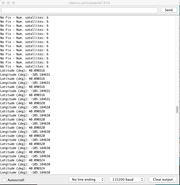
When you upload this code you'll have to wait ~24s to get a lock onto any satellites. After that first lock, the backup battery on the board will provide power to some internal systems that will allow for a hot start the next time you turn on the board. The hot start only lasts four hours, but allows you to get a lock within one second. After you get a lock the serial terminal will start listing longitude and latitude coordinates, as seen below. Make sure to set the serial monitor to 115200 baud.
These are the coordinates for SparkFun HQ
